


Home / Maps and Travel
Maps and Travel
Maps
Maps of Morecambe, Lancaster and the District can be requested or downloaded at the bottom of this page. OS Walking maps can also be ordered on the Gifts and Books page.
Travel
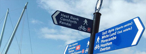
The District is located in the North West of England and is easily accessible by the different forms of transport (shown below). For further help contact our Tourist Information Centres.
We also have Information on Accessibility to our district with regard to getting around and parking etc.
By Road
Leave the M6 on Junctions 33-35.
Plan your route -
- AA - www.theaa.com
- RAC - www.rac.co.uk
View Motorway & Road Traffic Reports with Frixo.
Car Parking -
- Morecambe Car Park Map (pdf 1.4mb)
- Lancaster Car Park Map (pdf 1.1mb)
- Further information on Car Parking in the District
By Rail:
Lancaster is located on the West Coast Main Line which brings frequent Intercity Services from London Euston and Glasgow.
TransPennine Express also provide direct services from Manchester Airport and Edinburgh.
Regular services operate from Lancaster to the rest of the district. Visit National Rail Enquiries.
![]()
Other rail-routes include the Leeds-Lancaster-Morecambe Railway which travels through some of Yorkshire and Lancashire's loveliest countryside.
By Bus/Coach:
National Express Coach Services and Stagecoach buses operate in and around the district.

By Air:
The regions main airport is Manchester International. There is also Blackpool International Airport nearby.
By Cycle:
There is an excellent network of cycle tracks including the National Cycle Route 6. Visit Budgie Transport for details on cycle hire.
By Canal:
Through the revitalised canal network, it is possible to travel to Lancaster from London. A Waterbus links Lancaster and Carnforth.
Greenbank Farmhouse, Lancaster
Former dairy farm converted in the 80s, standing in extensive gardens with panoramic views....
- District Map
- 214 Kb

Map of district including Morecambe, Lancaster, Carnforth and the Lune Valley.
- Lancaster Map
- 1024 Kb
Visitor attraction and street map of Lancaster
- Morecambe Map
- 1 Mb
Visitor attractions and street map of Morecambe.


© Copyright 2008 Lancaster City Council
All rights reserved